Geographic Information System is an extremely useful means for compiling, filing, evaluating, and administering location data. These possibilities serve for improved control and optimized decision-making in companies. With the advent of intelligent twins, GIS in business is now applied even in a more effective manner. The simulations of real-world systems or objects that leverage the wealth of up-to-the-minute data to reflect and foretell behavior can now be combined with GIS in business analytics. Read on to discover the opportunities that this software will grant your enterprise, and in what fashion you can leverage them to make sound decisions.
Contents
Future-proofing your business: the benefits of embracing GIS in business intelligence
Let’s explore the improved outcomes that your company will achieve in various areas of its activity by relying on expert GIS analysis.
Supply chain optimization and logistics management
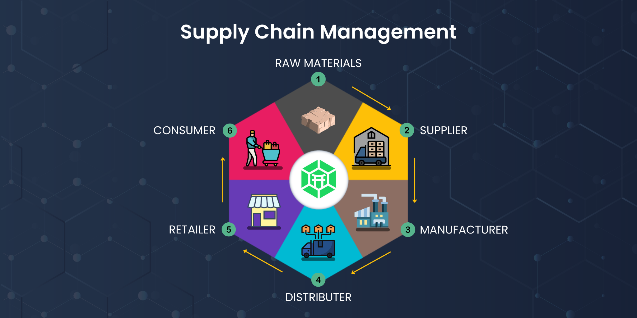
GIS and business analytics promise immense possibilities in enhancing transparency and oversight of supply chain activities. This is possible with up-to-the-minute inventory tracking, and immediate insight into production plans and shipping routes. Thus, you’ll be in the right position to spot possible impediments in the process and act proactively and react to mitigate potential adverse impacts. Ultimately, these measures will allow your company to effectively trim the outlay on logistics.
By furnishing a comprehensive location-based outlook of your operations, GIS in business intelligence provides for building the best possible delivery routes and indicates the most preferable locations for stockpiling and shipment facilities. This, in turn, guarantees not only lowering freight expenditures but also upgrading customer experience through a swift delivery turnaround. Furthermore, this secures streamlined alignment across the supply network thanks to expeditious data exchange.
Enhanced data visualization and communication capabilities
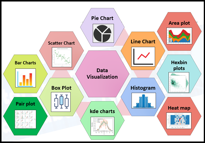
GIS and business analytics will also allow your company to generate interactive maps and develop graphical displays. What does this mean? By having access to geospatial data exploration in its entirety, you as a business owner will be granted the ability to deduce and convey valuable insights from complex data faster and easier.
By means of dedicated software that uses intelligent twins, a business avails itself of analytical modeling and predictions that are depicted in real-time. This guarantees you informed perspectives of your current and potential future operations and empowers you to act quickly and competently when spotting both challenges and possibilities for advancement on the horizon.
Moreover, implementing GIS in business fosters interdepartmental and cross-team collaboration as all the parties involved benefit from sharing a unified viewpoint of business-critical information. In this manner, you’ll be able to dismantle organizational barriers and establish a robust communication flow.
Better decision-making through predictive analytics and scenario planning
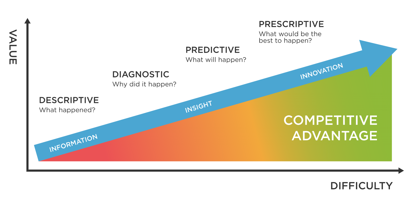
GIS analysis enables firms to formulate models that replicate diverse scenarios. This aids the parties concerned in projecting the impact of their decisions, e.g. rolling out new products, revising price models, or penetrating emerging markets. As a result, they substantially augment and refine their perception of likely drawbacks and upsides pertaining to alternate scenarios.
A comprehensive location-based outlook on activities uncovers likely pitfalls tied to transformations in the physical surroundings, e.g. the aftermath of natural phenomena and revisions to transportation itineraries. Thus, firms are in the right position to lessen the risks more proficiently.
How the world’s largest retailer uses GIS and intelligent twins
GIS and business analytics have been used in software development to automate and streamline inventory monitoring, resource management, machinery maintenance, etc. Below are three stunning GIS analysis examples that demonstrate how software revolutionizes the way some of the globally recognized retailers operate.
McDonald’s uses GIS to optimize store locations and market demographics
How can one successfully handle an enormous and convoluted fast-food restaurant chain that has units in more than a hundred countries? Moreover, how can one plan for the most convenient locations for their cafeterias so that people would give preference to their brand?
McDonald’s’ analysts have been efficiently tackling this challenge by turning to exhaustive GIS analysis. In this fashion, they closely evaluate consumer demographics and indicate well-placed spots with prominent visibility in the vicinity. As a rule, a well-versed GIS business analyst draws on demographic indicators like residential density, consumer spending patterns, and more, to recognize the most auspicious zones.
The immediate food service chain also leans on the software to evaluate the possible achievement of their market penetration campaigns. When a new venue is considered, the enterprise’s specialists perform a meticulous evaluation of the locality, namely, its demographic segmentation, traffic circulation, surrounding commercial entities, etc. These insights are reasonably implemented to substantially heighten the likelihood of success in unexplored venues.
Last but not least, the franchise refines shop floor plan, employee count, and inventory variety on current sites by dint of going by the received analytics. Thus, the company maintains the superior level of services that its frequenters value so much in various corners of the world.
IBM uses intelligent twins for predictive maintenance of industrial equipment
When composing our series of outstanding GIS analysis examples, we couldn’t fail to mention this behemoth in the technology world that is known as a trailblazer in development and innovation in a plethora of areas. These include but are not limited to aviation, manufacturing, health industry, freight, oil and gas sector, etc.
What is IBM’s success formula for prospering in all of these fields? They fashion virtual representations of physical structures for condition-based maintenance and machinery tracking.
For instance, their experts fine-tune plane engine speed and passenger compartment climate via intelligent twins. Thus, they can pinpoint complications spotted on these models in a timely manner, lowering the chance of shutdowns and ameliorating operational safety and stability.
The development of virtual versions of oil drilling rigs and other facilities is yet another noteworthy case of GIS implementation. The corporation aids its customers in following vibration amplitude metrics and heat gauges. Thus, they are in the right position to forestall mishaps and safety occurrences and boost their financial results.
Walmart uses intelligent twins for demand forecasting and inventory management
The ultimate of our outstanding GIS analysis examples is the work of this legendary retail empire. How can one cater to the expectations of millions of clients with equal effectiveness? And what’s the key to robust inventory oversight?
The network has embraced technology to estimate the necessary order volumes. The details that they pay special attention to are sales analytics, market dynamics, and buyer purchasing tendencies. Accordingly, they prevent unfavorable situations like oversupply and inadequate stock.
Furthermore, to systematize and handle its impressive stockpile in an accurate and effectual fashion, the network falls back upon the development of intellectual models of its stores. Thus, their specialists are able to continuously trace product flow in order to uncover potential shortfalls and make adjustments accordingly.
To wrap up
As one can conclude from the aforesaid, a proficient GIS business analyst can extensively bolster one’s data analysis techniques and decision-making practices by leveraging state-of-the-art technological capabilities. The applications of GIS that one can bring to fruition are truly multifarious, from fine-tuning supply chain logistics and coordination to rationalizing stockpile replenishment and refining information mapping.
McDonald’s, IBM, Walmart, and other world-recognized leaders achieve their heights not least thanks to incorporating these systems into their flows. In reality, as these tech products keep advancing, we’re likely to witness even greater transformations in industries in years to follow.
To bring these advances to fruition and excel in data-centric environments, one can turn to an accomplished GIS software development company, e.g. Andersen. By integrating your firm’s ecosystem with a smart custom solution, you’ll benefit from the following perks:
- Strengthened forecasting accuracy as for operational output,
- enhanced information capturing and processing capacity,
- clear detail mapping that alleviates comprehension and interpretation of insights,
- fostered interdepartmental cooperation, and more.
By proactively embracing these tech advancements, your firm will stay on the cutting edge and gain traction in a swiftly changing market.


![Index of Money Heist [Season 1, 2, 3 & 4 – All Episodes, Cast and Plot] Index of Money Heist](https://www.asiamediajournal.com/wp-content/uploads/2021/05/Index-of-Money-Heist-3-100x70.jpg)